
Signed in as:
filler@godaddy.com
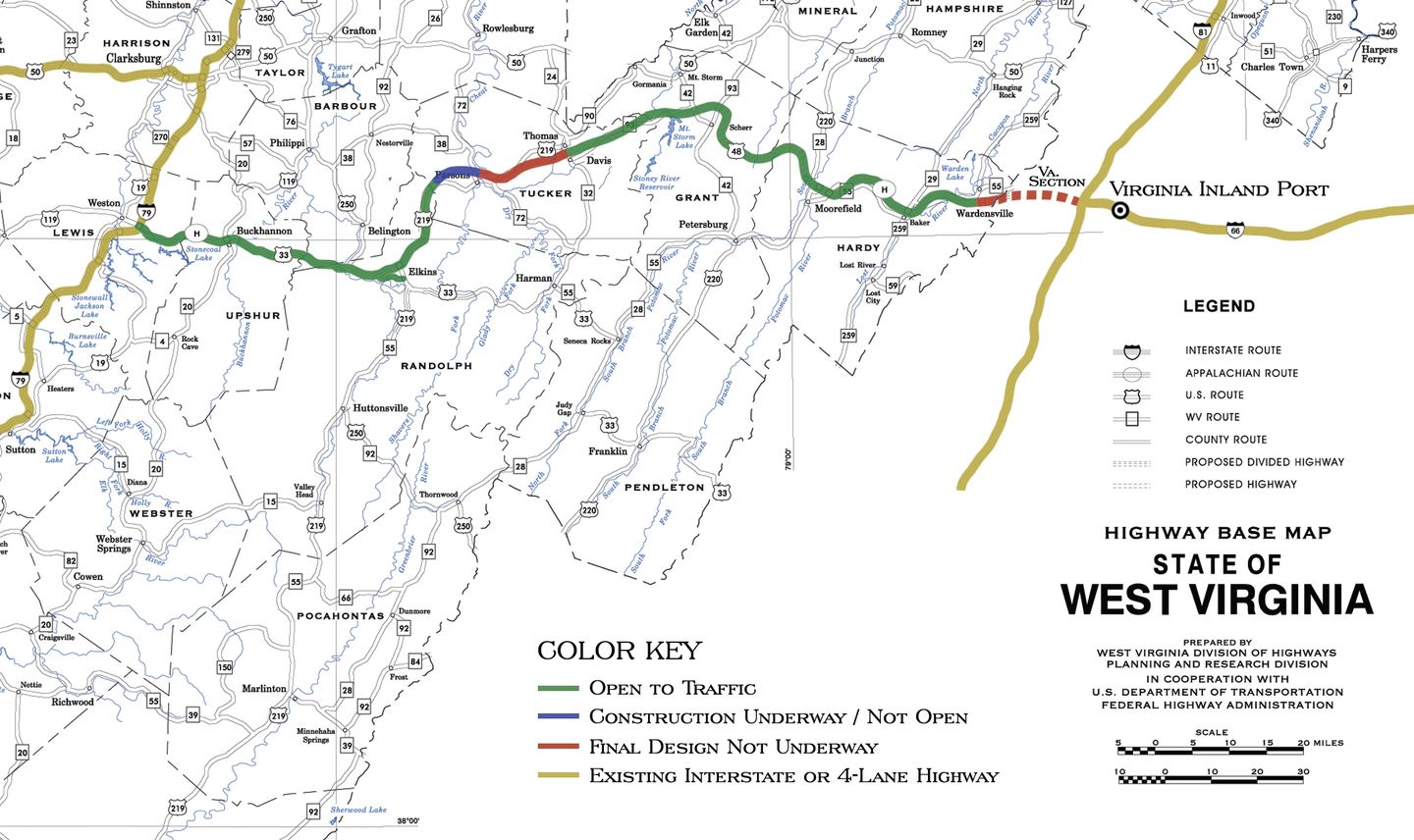
The sections of Corridor H highlighted in green are completed and drivable. Blue sections are under construction/engineering currently, and the small amount of red highway is yet to be built.
The gold sections on the map above illustrate current 4-lane highways that Corridor H will help connect. These include I-81 and I-66 in the east and I-79 and US Route 50 in the west. The Virginia Inland Port is located on I-66 just east of where Corridor H will join I-81 – providing much-needed access to international ports for West Virginia manufacturers and new jobs for Virginia as those goods come from the Mountain State.
When complete, Corridor H will stretch 130 miles across the mountains from I-79 at Weston, cross the border into the Commonwealth of Virginia and travel 13 miles to meet the junction of I-66 and I-81 and open an entire region to new economic development and increased tourism.
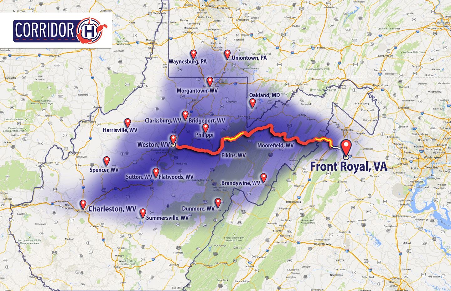
This map shows every point in West Virginia that takes 3.5 hours to drive to the Virginia Inland Port. Once at the port, it takes about an hour to drop off the truckload, then another 3.5 hours to drive back to the original point. This round trip drive will make for a normal eight-hour workday.
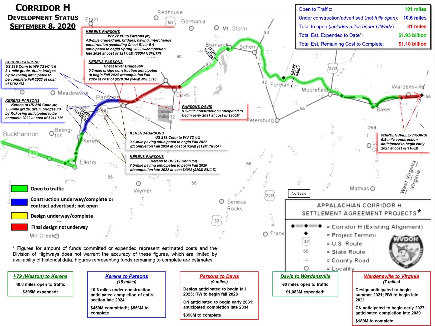
This map details the Corridor H development schedule and projected costs as of September 8, 2020.
Map courtesy of West Virginia Department of Transportation.
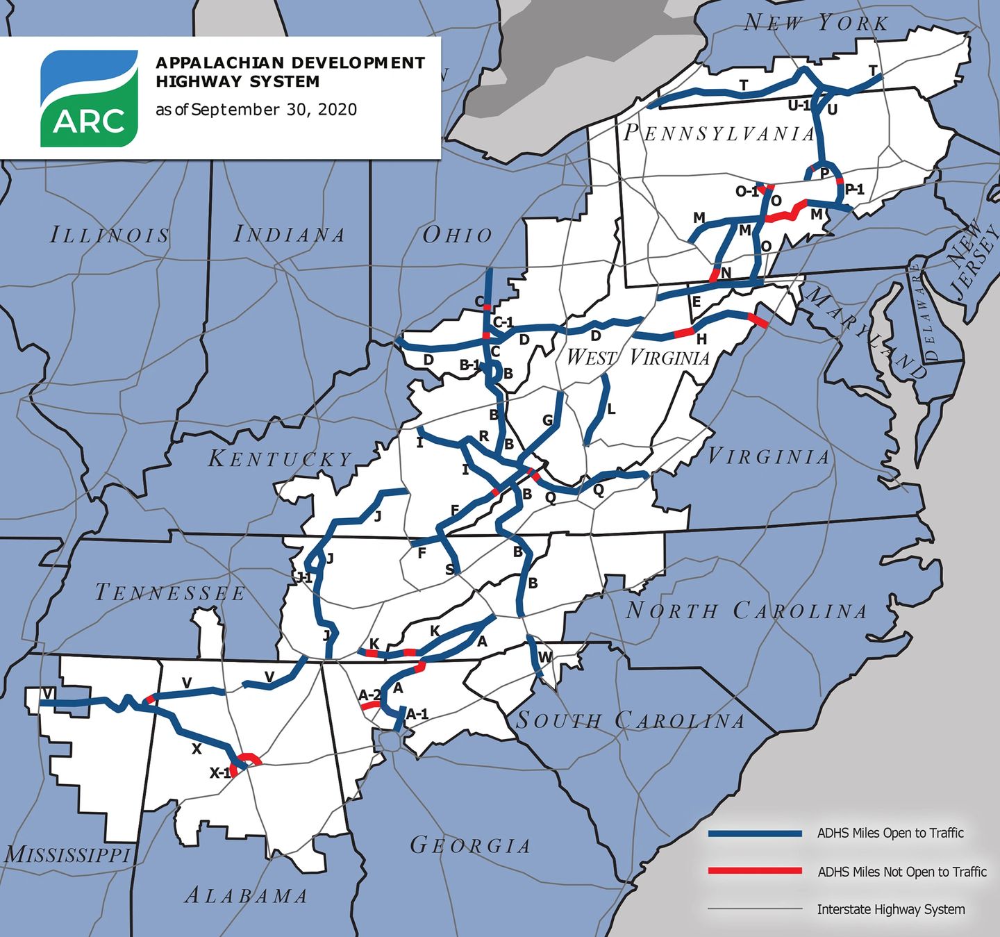
This map from ARC displays the development progress of the entire Appalachian Development Highway System as of September 30, 2020.
Map courtesy of Appalachian Regional Commission.